Howth (Old Abbey) Cemetery
Howth (Old Abbey) Cemetery is located within Howth village and is set on a height overlooking the harbour. The upstanding archaeological features at the site are late medieval in date.
Historical Context
Sigtrygg (Sitric), King of Dublin, founded the original church on the site c.1042. In 1235 it was amalgamated with the church on Ireland’s Eye and Luke, Archbishop of Dublin rededicated it to the Blessed Virgin Mary. Much of the current abbey building dates to the late 14th and early 15th centuries and it was further added to and altered in the following centuries. To the south of the abbey are the ruins of a 15th or 16th century college where members of the community lived.
In the southeast corner of the south aisle of the abbey is the chantry chapel which contains the tomb of Christopher St. Lawrence, 13th Baron of Howth who died 1462 and his wife, Anna Plunkett of Ratoath. The tomb was carved c.1470 and carries the effigy of the knight and his wife. William, Lord of Howth was also buried in his family vault here in 1671. Burial markers in the graveyard can be dated from c.1050 onwards. Other monuments and features of interest include a holy well located in the retaining wall of the abbey graveyard. This has been called the ‘eye spout’ or ‘holy spout’. Water is now issued from a short length of pipe which is said to have come from a holy well dedicated to the Virgin Mary. Local tradition records that the well had the cure for sore eyes. The burial ground finally closed 31 May 1973.
Archaeological and Architectural Features
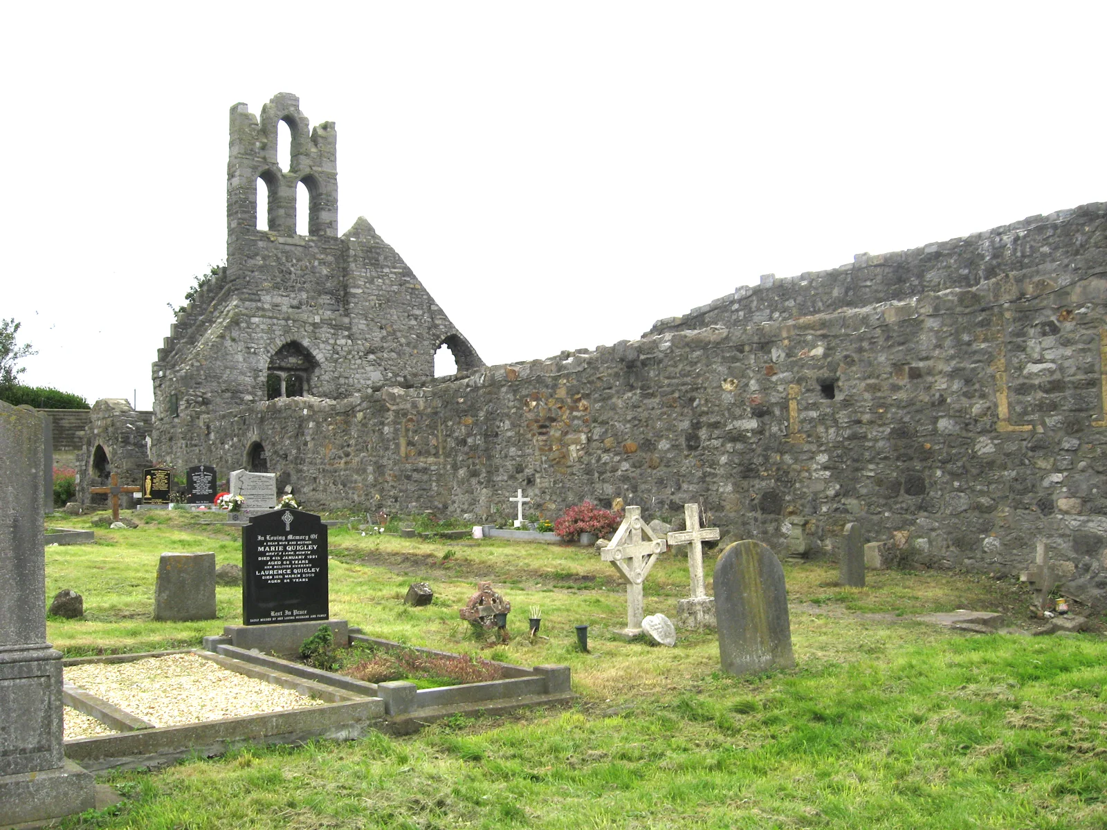
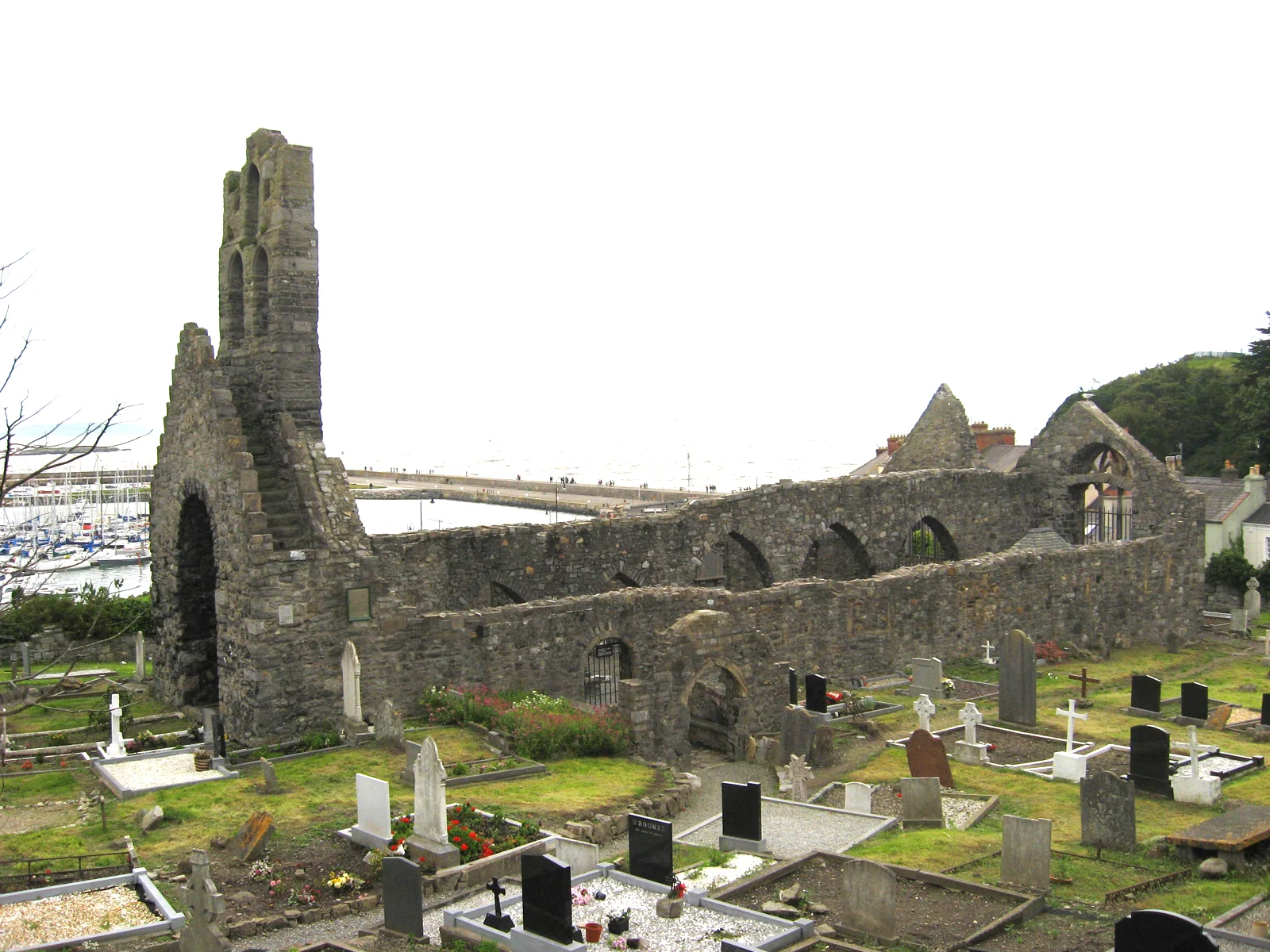
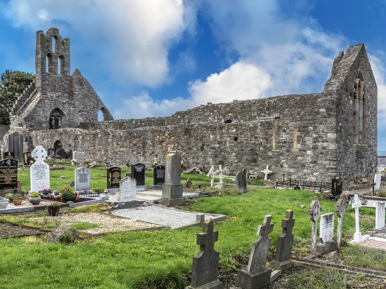
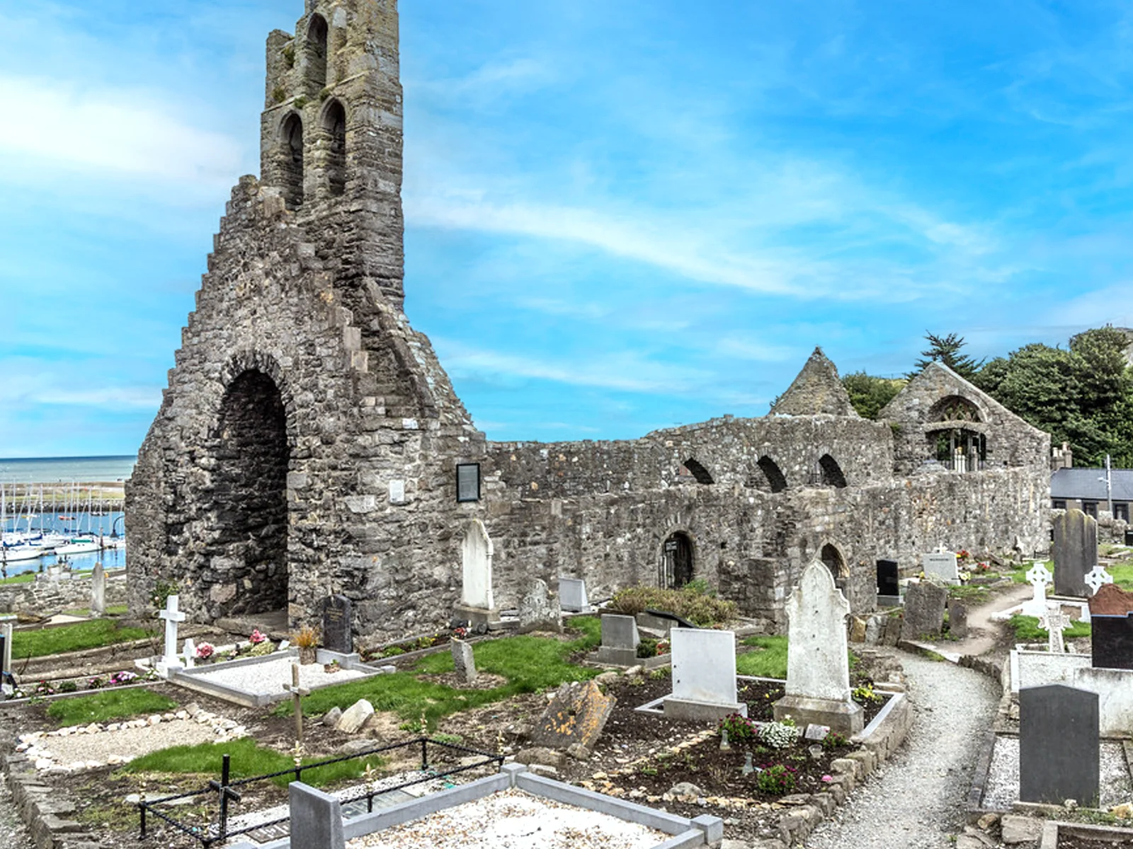
The standing remains within the graveyard consist of double aisled church divided by an arcade. It is constructed in random rubble limestone. There is a triple bellcote to the west gable. There is a triple light window in the east wall. There is a medieval grave slab built into the kerbing in the southwest corner. The church contains a mid 15th century alter tomb dedicated to the Lawrence family.
General Description
Square graveyard, bounded by rubble limestone wall with curved battlements to the east wall. The southern boundary includes a number of late medieval structures. The graveyard is set on a height overlooking the harbour. The graveyard contains a mixture of 18th, 19th, 20th and 21st century markers with some medieval markers. The grave markers are predominately east-facing and carved from marble, limestone and granite. Some are some simple undecorated stones and some table tombs with limestone slabs and granite legs. There is loose stone across much of the southern portion of the graveyard. There are a number of reused architectural fragments. There are two medieval grave slabs attached to the east and south wall of the south aisle in the church. Both slabs bear an inscribed cross with a stepped base. A third is located to the west of the church and has been reused in the kerbing of the flowerbed - it is sandstone slab with a stepped base and thin cross shaft carved on it.
Fingal County Council is responsible for this cemetery and its records.
Surveys: JAPMDI v p194-197, viii p321; OPW Survey. Dublin Corp. Plot Map 1962 Pearse Street Library. M.J. Egan Vol.9 p91-138
Directions to Howth (Old Abbey)
Tip: directions will open in a new tab. You may need to enter your starting location manually.