Grallagh Cemetery
Grallagh Cemetery is located in tillage fields on a third class road to the west of the R122. A ditch curves around the south and southwest sides of the graveyard, possibly representing the line of an early medieval enclosure. The graveyard also contains a holy well.
Historical Context
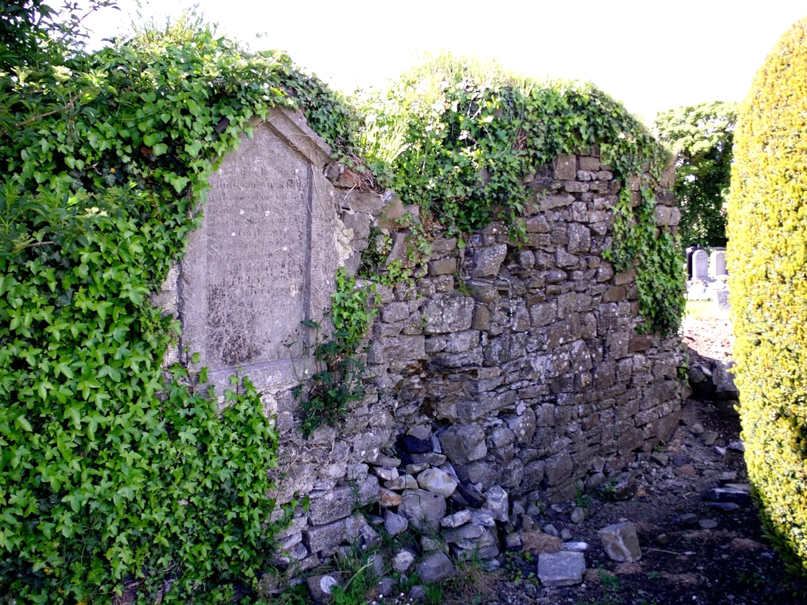
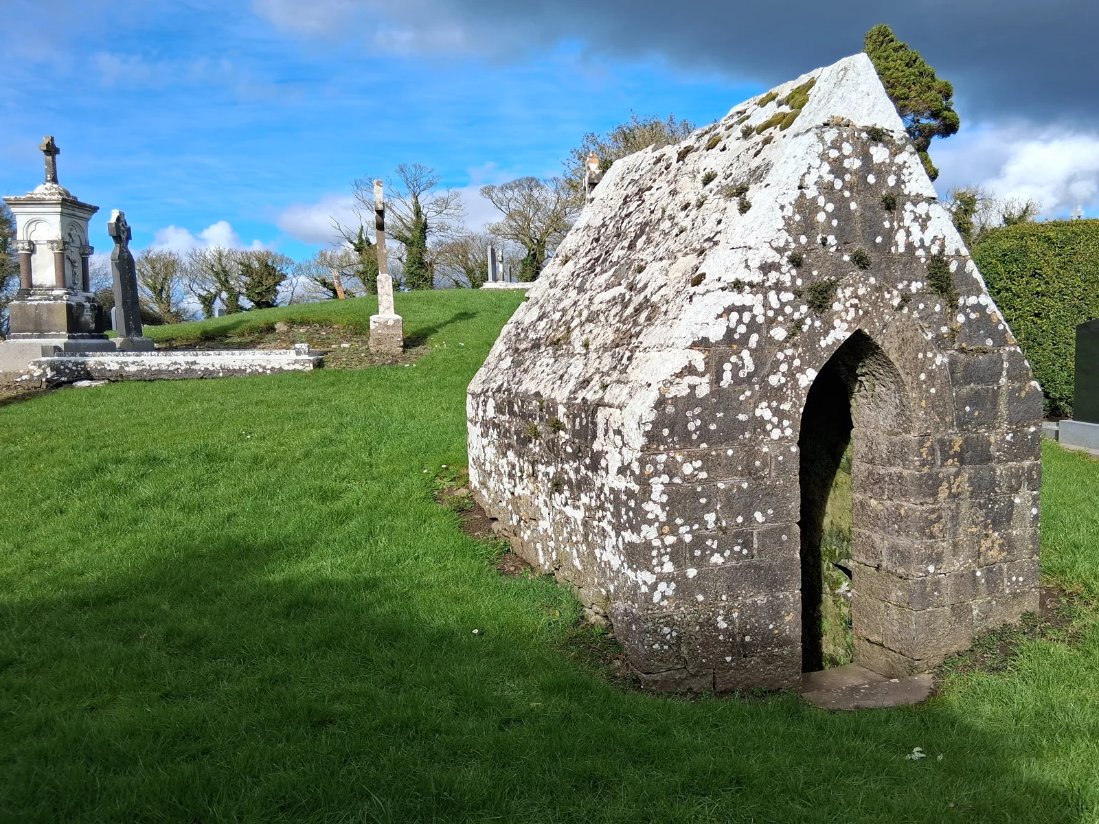
The church of Grallagh was dedicated to St. Michael and is situated within the confines of a walled graveyard. A curve in the south end of the graveyard wall indicates the possible existence of the early medieval ecclesiastical enclosure. The remains of the medieval parish church, which was certainly built before 1306, are visible. The west gable is still standing. The interior now contains a 19th century headstone which has been inserted into the masonry.
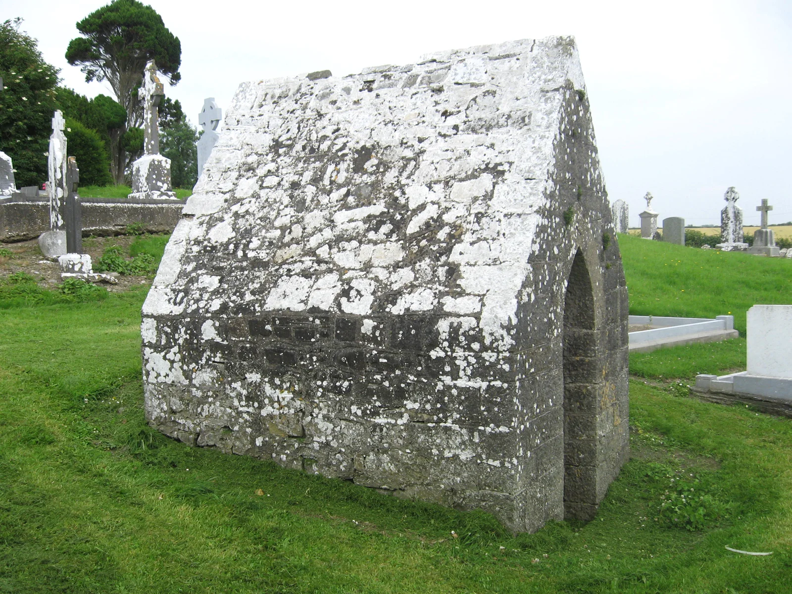
In the south end of the graveyard is a holy well known as St. Michael's Well which is said to cure whooping cough. This is accessible from steps which are covered by a late stone building. The pattern day was once held on the first Sunday in August. Local records indicated that the well was dedicated to St. Patrick and cured both whooping cough and sore eyes. Additional elements of interest include an irregularly shaped boulder outside the graveyard which is traditionally believed to be the mark of St. Michael and a cure for backache.
Archaeological and Architectural Features
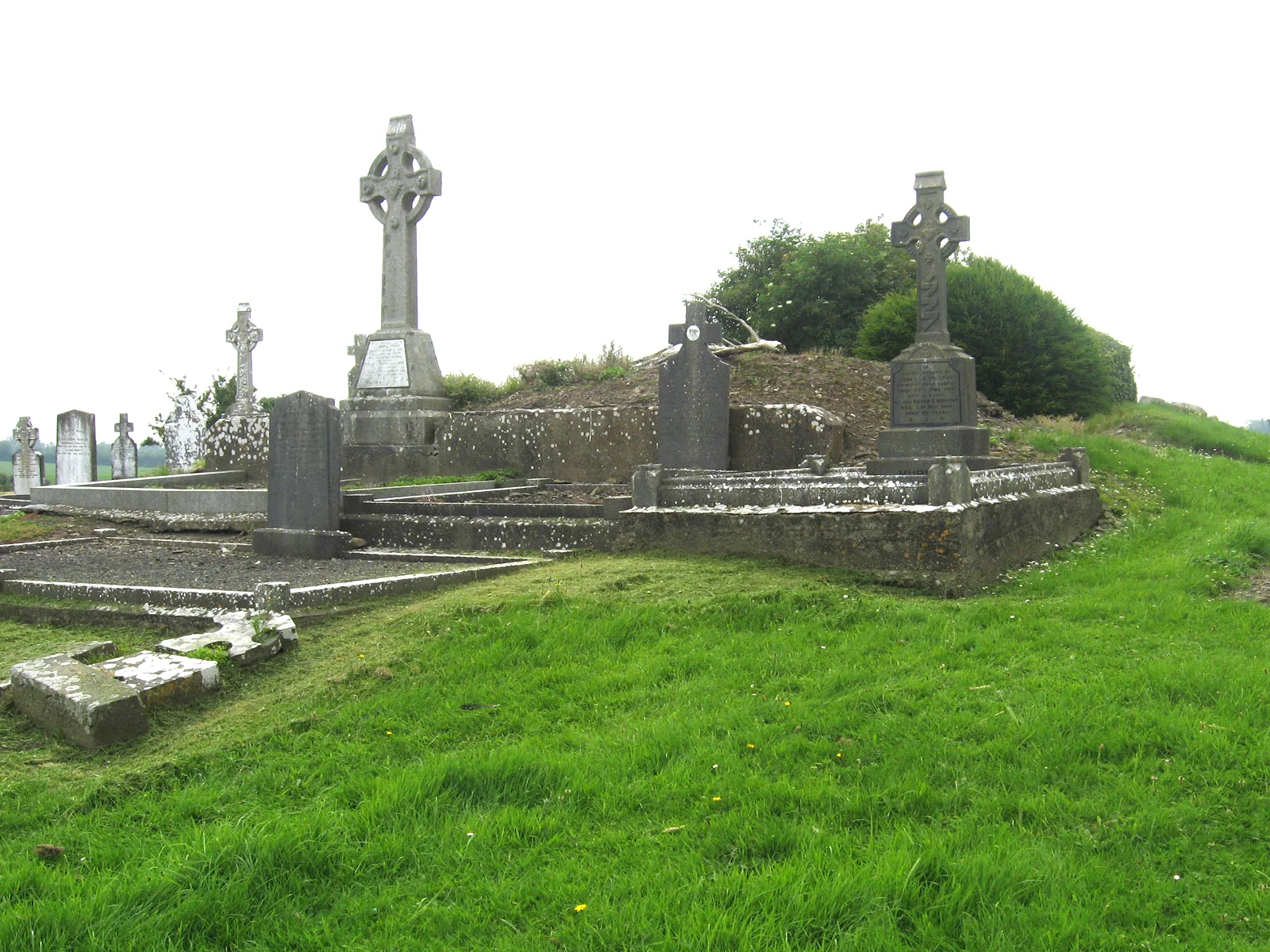
There are the ruins of a medieval church at the highest point within the graveyard. The west wall is constructed of roughly coursed limestone which survives to a height of c.2m. The other walls survive as earthen and stone foundations. The remains are covered in vegetation. An irregularly shaped boulder is located outside the entrance to the church. It is said to bear the mark of St. Michael. The graveyard may originally have been surrounded by an enclosure during the early medieval period. The enclosure is curved and comprises a deep ditch on the northern, western and southern boundaries.
General Description
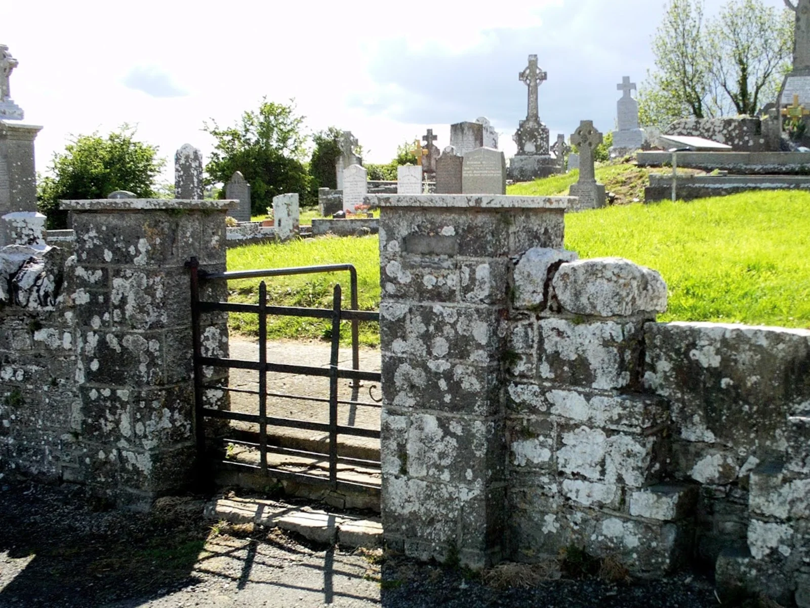
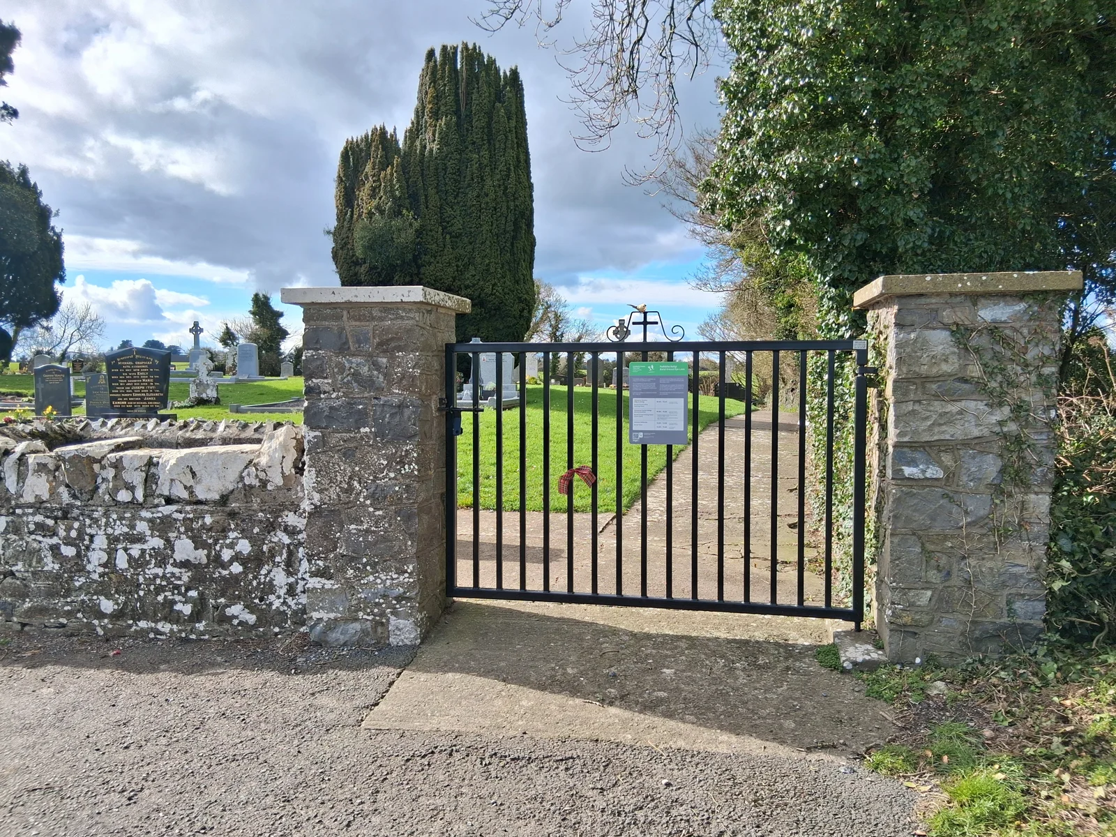
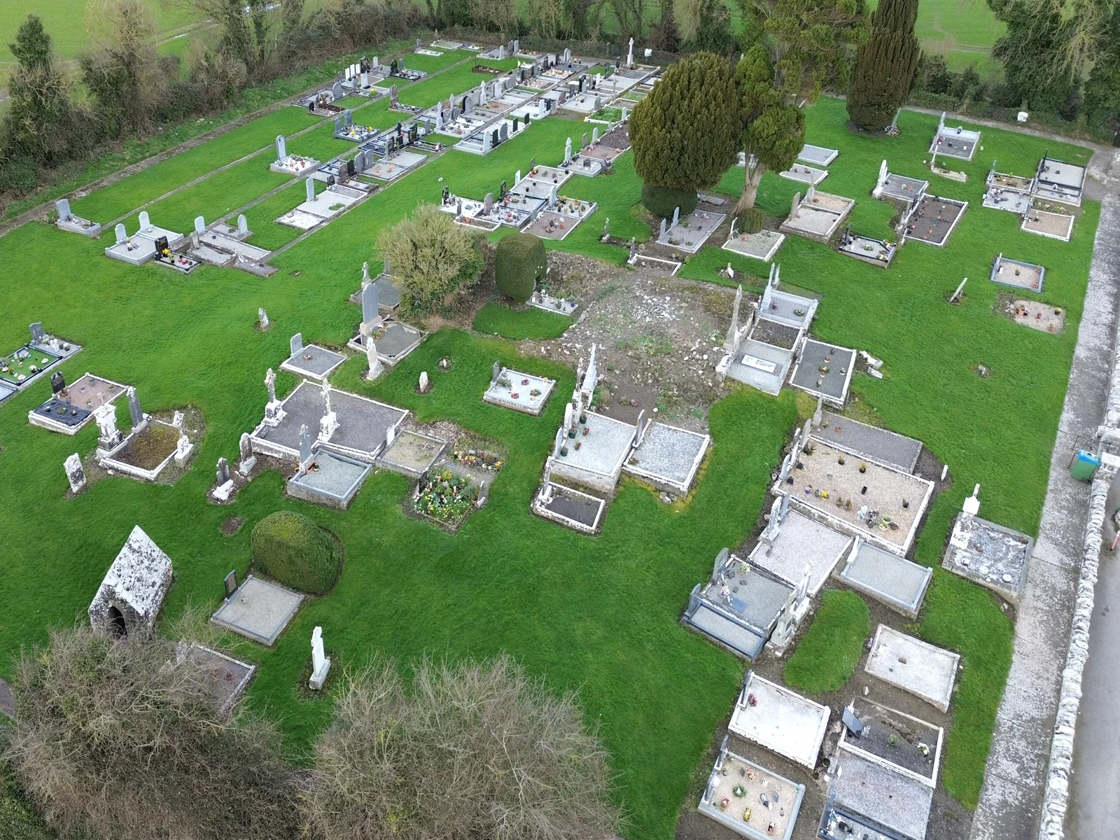
Sub-rectangular graveyard bounded by a limestone wall with coping on the east side. The other sides are bounded by a ditch which curves around the south side of the graveyard, possibly representing the line of an ecclesiastical enclosure. There is a cast-iron gate and stone stile to the east wall. The ground level is higher than the surrounding area and there is a significant rise of ground within the graveyard towards the church. The ground within the graveyard is undulating.
The graveyard contains 18th, 19th, 20th and 21st century grave markers comprising headstones and free standing crosses. The headstones have curved or straight tops. There earliest inscribed marker in the graveyard dates to the late 18th century. It is inscribed as follows "IHS This stone was erected by Anna Doran in memory of her husband Thomas Mangan who departed this life Mar ye 18th 1768 aged 44 years". The modern burial plots are concentrated in the western end of the graveyard.
Fingal County Council is responsible for this cemetery and its records.
Surveys: JAPMDI xii p396-399. M. Egan Vol.5 p114
Directions to Grallagh
Tip: directions will open in a new tab. You may need to enter your starting location manually.