Balrothery Cemetery
Balrothery Cemetery is located on a small rise of ground within the village. The village is surrounded by relatively flat pasture land. While there are no standing remains associated with the early medieval site documentary evidence points to the existence of church here prior to the 13th century. The graveyard formerly extended beyond the current boundary wall and archaeological excavations have uncovered burials outside the current boundary and evidence for a possible enclosure.
Historical Context
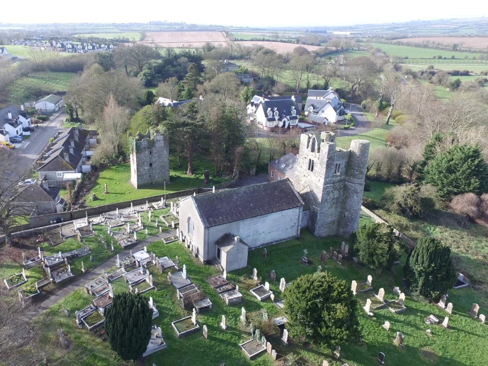
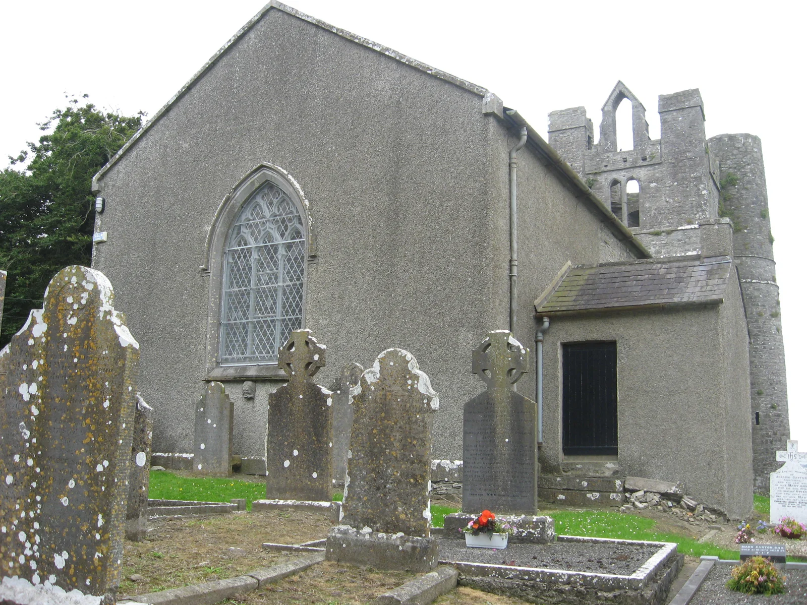
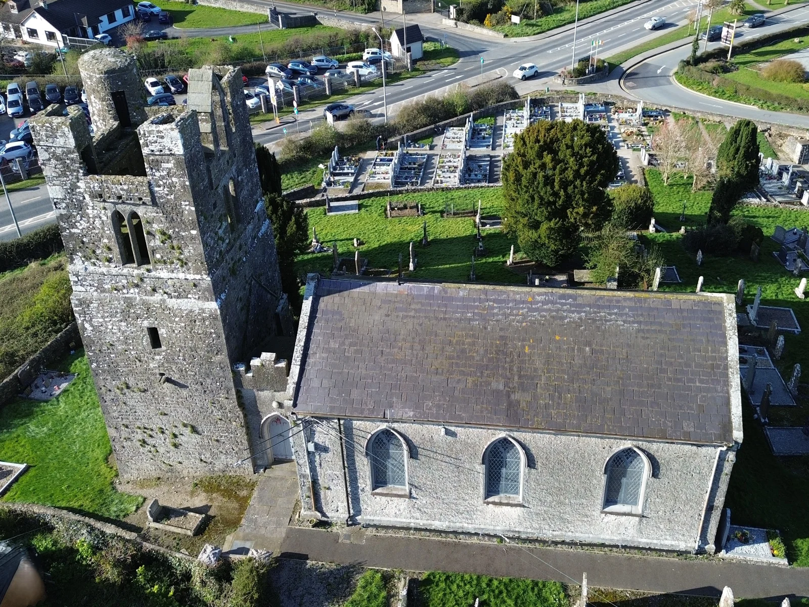
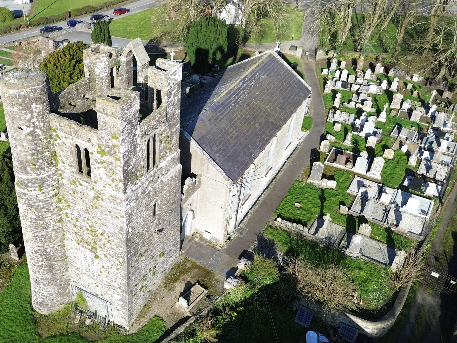
While there are no standing remains associated with the early medieval site there was a church at Balrothery, dedicated to St. Peter, prior to the 13th century. After the Norman conquest, the lands were in the possession of Geoffrey de Constantine. All that remains at the site of the later medieval church are the remnants of an early 16th century tower. It has a round corner tower, stepped parapets and strongly battered walls (McMahon 1991, 15). The current church which can be seen today was built in 1816 AD.
The graveyard contains the headstone of Patrick Farrell, a local blacksmith who died in 1727. Farrell’s forge was located in the village and he is said to have shod King William’s horse on his return from the Battle of the Boyne. The stone is decorated with blacksmiths tools including a pincers and hammer. Another memorial in the graveyard commemorates the victims of the sinking of the "Belle Hill" which was wrecked on the rocks north of Balbriggan in February 1875. St. Peter and St. Paul are the patron saints of the parish of Balscadden and Balrothery. Their feast day is on the 29th June and the Balrothery Pattern is held on this day. In 1014 after the Battle of Contarf Brian Buru's corpse was left for one night in the church of Balrothery while the soldiers watched in the graveyard.
Archaeological and Architectural Features
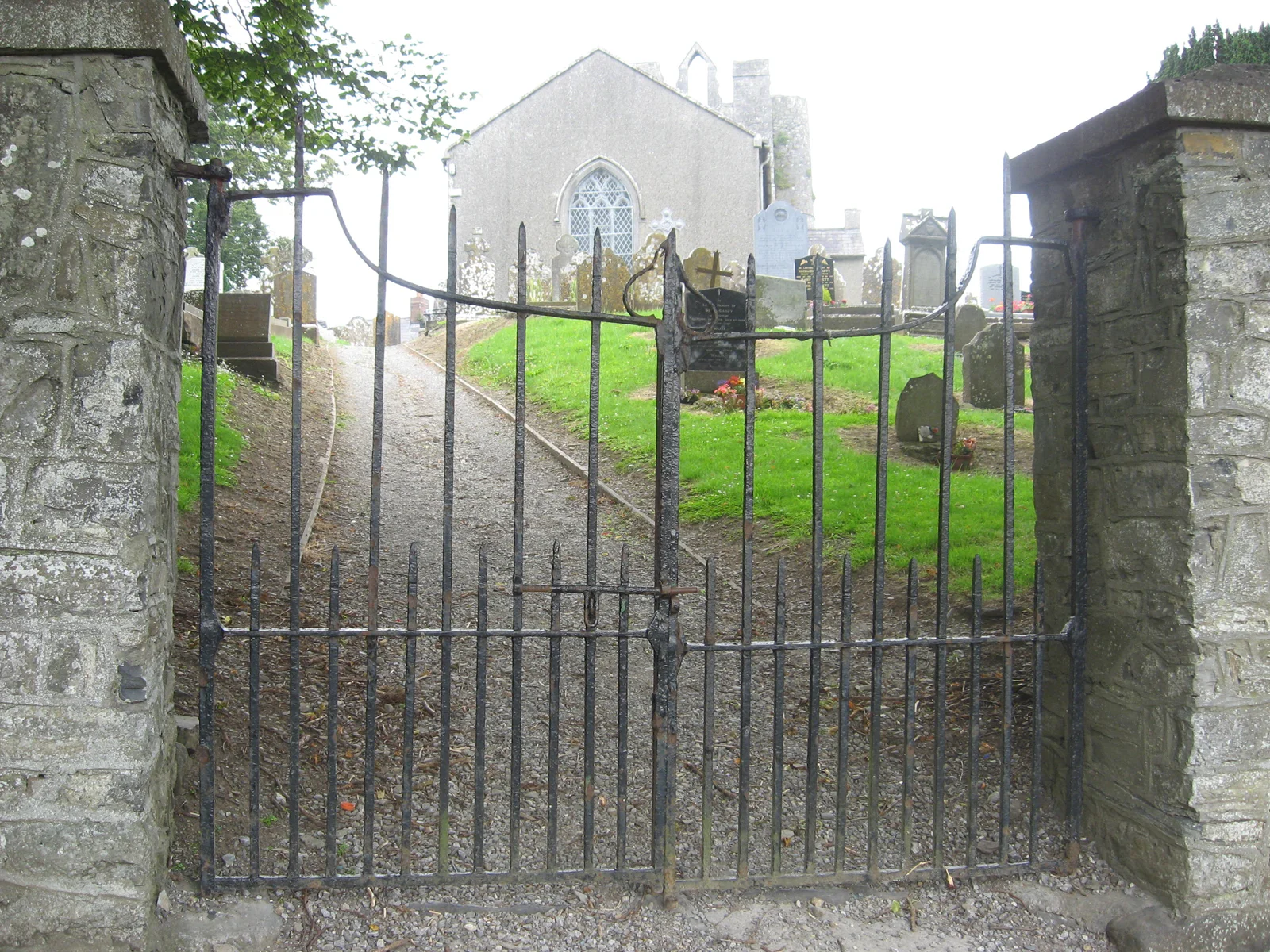
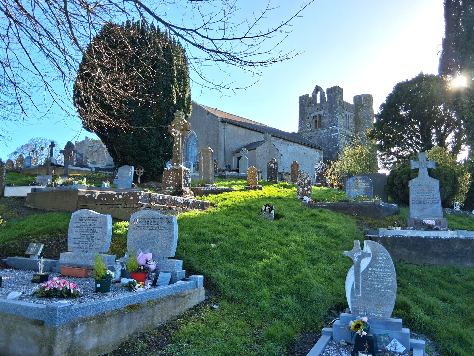
The standing remains are located within the village of Balrothery and consist within the graveyard containing an early 19th century church with a medieval tower at the west end. The early 19th century Church of Ireland church has rendered rubble limestone walls and a single span pitched slate roof. The three-bay nave has pointed arched windows to the south elevation with hood mouldings and stone sills. The entrance is in a porch to the south wall. There is a stoup or font on the ground near the entrance to the rectory to the north of the church. A medieval carved head has been reinserted.
General Description
Sub-rectangular graveyard bounded by a roughly dressed stone wall. The boundary wall to the south consists of a low rubble stone wall. The graveyard is entered through cast-iron gates with a stone stile to the northeast. There is a small modern extension to the north. The graveyard contains a number of yew trees. The entrance to the rectory is located to the east of the church. The ground level is built up significantly within the graveyard and rises towards church.
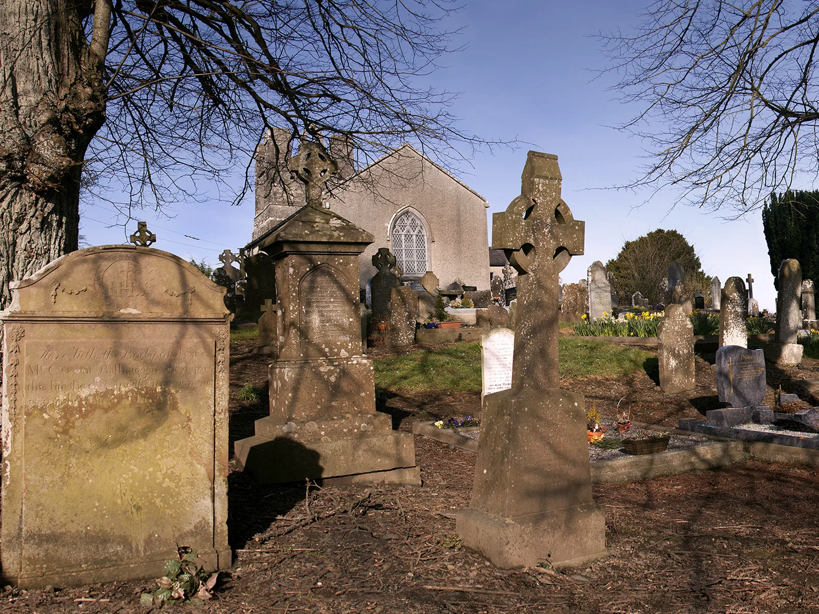
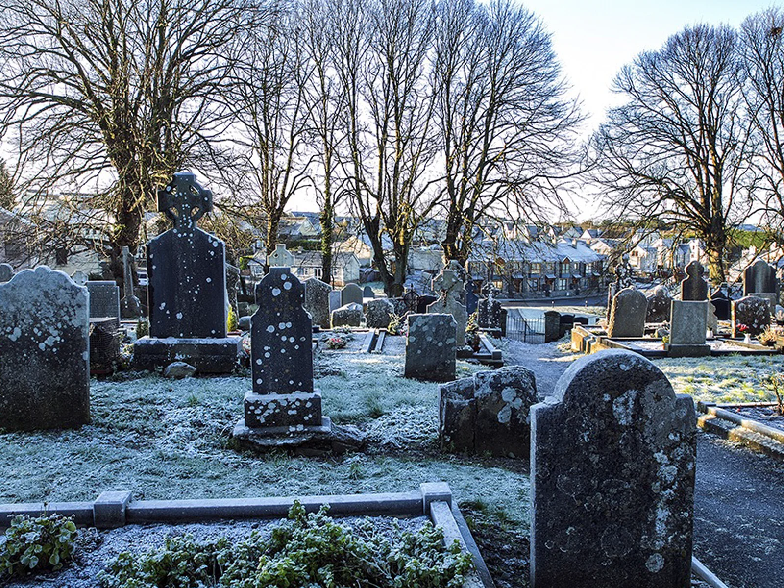
The graveyard contains a significant number of grave markers of 18th date along with 19th, 20th and 21st century examples. The graveyard contains a significant group of early 18th century inscribed headstones. The graveyard contains headstones, free-standing crosses and a large number of box and table tombs. The modern grave markers are concentrated in a small extension to the north of the church. Many of the headstones are inscribed and decorated with IHS markers. There are a number of First World War graves of standard military design including that of "25940 Private N Keegan Royal Irish Fusiliers, 3rd May 1918". There is a significant reused architectural fragment which represents a possible mill stone. It has a large square hole in the centre and is inscribed as follows "Here lyeth ye body of Frances Davis first wife to Samuel Brown who dyed Apl 30th 1715. Also ye body of Sarah Brown daughter to ye said Brown by his 2nd wife Elizabeth", the rest of the inscription is hidden.
The earliest inscribed stone is early 18th century in date and is located in a group to the south of the church. It is inscribed as follows "Here let the body of Robert Telling who dyed 9br ye 8th 1710". There are re-used architectural fragments forming the kerbing of a modern plot to the northeast of the church. Many of the plots to the south of the church are surrounded by cast-iron railings. There is an irregularly shaped pillar stone at the east end of the church. An inscribed headstone has been set into the southern pillar at the entrance to the graveyard.
The buildings are looked after by the OPW. Fingal County Council is responsible for this graveyard and its records.
Surveys: JAPMDI viii p45-49; Irish Mem. Assoc. Journal xii p399-404; Dr. Egan Vol.6 p42-116
Directions to Balrothery
Tip: directions will open in a new tab. You may need to enter your starting location manually.